Indonesia earthquake kills at least 20 people after 7.7 tremor strikes Flores Island
A shallow 7.7-magnitude earthquake off Indonesia's Flores Island triggered mass evacuations, minor tsunami waves, and landslides that are hindering rescue operations.

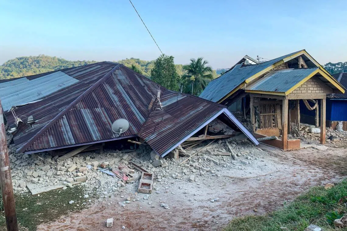
A powerful magnitude 7.7 earthquake struck off the coast of Indonesia's Flores Island on Saturday morning, August 15, 2026, leaving at least 20 people dead and triggering frantic mass evacuations as a temporary tsunami warning swept across the region. The shallow tremor, which struck at a depth ranging between 10 and 15 kilometers, centered near Mbay town in the Nagekeo Regency and roughly 68 kilometers northwest of Ende. The violent shaking lasted for approximately one minute, collapsing structures and driving terrified residents and hospital patients into the streets before emergency services could mobilize.
As rescue operations gathered pace across East Nusa Tenggara, an early information gap emerged between local and provincial tallies. Fathur Rahman, head of the local rescue agency reporting via AFP and detailed by the Straits Times, confirmed that 20 people had died across four different towns on the island, with six injured and two still buried under debris. Conversely, East Nusa Tenggara Governor Emanuel Melkiades Laka Lena and the national disaster management agency BNPB initially cited lower preliminary figures of two to five fatalities as data compilation began. The governor noted that several of the early victims had perished from collapsing rubble as they slept.
Related YouTube video


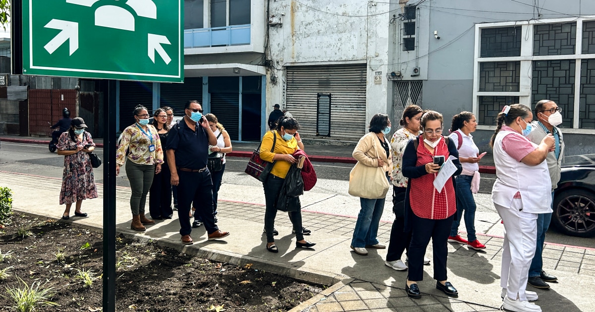
The earthquake struck shortly before 5 a.m. Local time, catching families during their morning routines. In Talibura Village within Sikka Regency, 51-year-old resident Nona recalled that 13 family members fled their home as the jolt hit. In Nagekeo, about 2,000 residents abandoned their homes, seeking refuge in the hills as the sea briefly retreated—a phenomenon that prompted Indonesia's Meteorology, Climatology, and Geophysics Agency (BMKG) to issue an urgent tsunami warning. BMKG tide gauges subsequently detected minor tsunami waves ranging from 0.17 to 0.36 meters in coastal spots including Sikka, Labuan Bajo, and Dompu. Australia's tsunami warning centre quickly clarified that the undersea tremor posed no tsunami threat to the Australian mainland, islands, or territories, and BMKG lifted its alert roughly three hours after the initial strike.
Emergency responders face severe logistical hurdles in the disaster zone. Rescue efforts have been heavily impeded by landslides that cut off critical roadways, blocking access to isolated communities and leaving authorities struggling to clear debris from damaged warehouses, government facilities, and homes. Hospitals in Ende were forced to wheel patients outdoors, while videos verified by Reuters showed parts of buildings collapsing into dust at the port of Maumere. The Chinese Consulate General in Denpasar issued alerts urging tourists in Labuan Bajo and surrounding districts to stay clear of coastal areas and remain vigilant against subsequent tremors.
The catastrophe highlights the persistent vulnerability of the Indonesian archipelago, which spans roughly 17,000 islands and houses over 270 million people along the Pacific "Ring of Fire," an arc of intense seismic activity. Indonesia's modern history is punctuated by catastrophic seismic events, including the devastating 2004 Sumatra megathrust earthquake and tsunami, the 2018 Lombok tremors, and the 7.5-magnitude quake and tsunami in Palu later that same year. Saturday's 7.7-magnitude mainshock was swiftly followed by powerful aftershocks measuring 6.1, 5.9, and 5.6 in magnitude.
Disaster authorities warn that the casualty count is expected to climb as rescue crews cut through blocked routes and clear rubble from hard-hit areas.
Widespread Tremors and Evacuations Across Provinces
The violent ground motion extended far beyond the immediate epicentral zone, with tremors recorded across multiple provinces including West Nusa Tenggara and South Sulawesi, according to statements from the National Disaster Management Agency (BNPB) reported via The Straits Times. Residents on Lombok Island described waking to severe shaking that disrupted morning routines. Veronika, a resident of Mataram, told Antara (as detailed by Tempo) that the swaying caused mild dizziness as families prepared children for school, while another resident, Adam, recounted a violently shaking bedroom. In Nagekeo Regency, local resident Yohanes Babo noted that marketgoers fled as the earth shook, successfully reaching the hills before any structural collapses occurred nearby.
- Early tsunami early warnings covered four provinces: East Nusa Tenggara, West Nusa Tenggara, South Sulawesi, and Southeast Sulawesi.
- BMKG tide gauges recorded minor tsunami waves, including 0.19 meters in Sikka, 0.36 meters in Labuan Bajo, and 0.17 meters in Dompu.
- Abdul Muhari, an official at BNPB, urged residents along the northern and southern coasts of Flores and surrounding islands to carry out self-evacuations by moving more than two kilometers inland or ascending hilly areas higher than 10 meters, as reported by The Punch.
Response efforts remain heavily constrained by damaged infrastructure. East Nusa Tenggara Governor Melki Laka Lena told reporters in Kupang (via China Daily) that roads in several districts remain blocked by landslides while officials continue compiling comprehensive damage assessments. Meanwhile, the Chinese Consulate General in Denpasar issued safety advisories instructing tourists in Labuan Bajo to stay away from coastal areas and remain alert for continuing seismic activity. BMKG officials state that the next step requires continuous sea-level monitoring and vigilance against further aftershocks as emergency crews push deeper into isolated terrain.
How significant is this development?
Contribute your assessment to the aggregated reader intelligence ledger.
Archypedia is dedicated to independent, evidence-backed reporting. This briefing was synthesized from primary source reporting, corroborated across independent newsrooms, and verified against our Editorial Standards.
Transparency record
Evidence behind this report
This report synthesizes 5 distinct sources. Open the source ledger below to compare the underlying coverage.
Prepared under the Archypedia Editorial Policy by the Samir Haddad editorial desk profile. AI-assisted tools may support drafting and verification; public accountability remains with Archypedia. Report an error.