Mưa lớn nhấn chìm nhiều tuyến đường, người dân TP.HCM chật vật về nhà
Severe flooding left key arteries submerged under half a meter of water, trapping commuters and forcing emergency rescues during the evening rush hour.
Quantitative Analysis of the Precipitation Peak
Data from the Southern Regional Hydro-Meteorological Station reveals a massive disparity in rainfall distribution across the metropolitan area. Between 07:00 and 21:00 on September 10, the volume of water trutted down exceeded the capacity of the city's low-lying infrastructure. The most severe peaks were concentrated in the east and north, with the Cát Lái area recording the highest volume.| Location | Recorded Rainfall (mm) |
|---|---|
| Cát Lái | 124.6 |
| Củ Chi | 119.8 |
| TP. Thủ Đức | 108.8 |
| Hóc Môn | 97.0 |
| Dĩ An 1 | 94.0 |
| Nhà Bè | 85.6 |
| Bình Chánh | 82.8 |
Infrastructure Collapse at Peak Hours
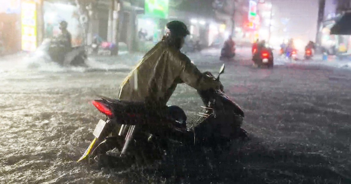
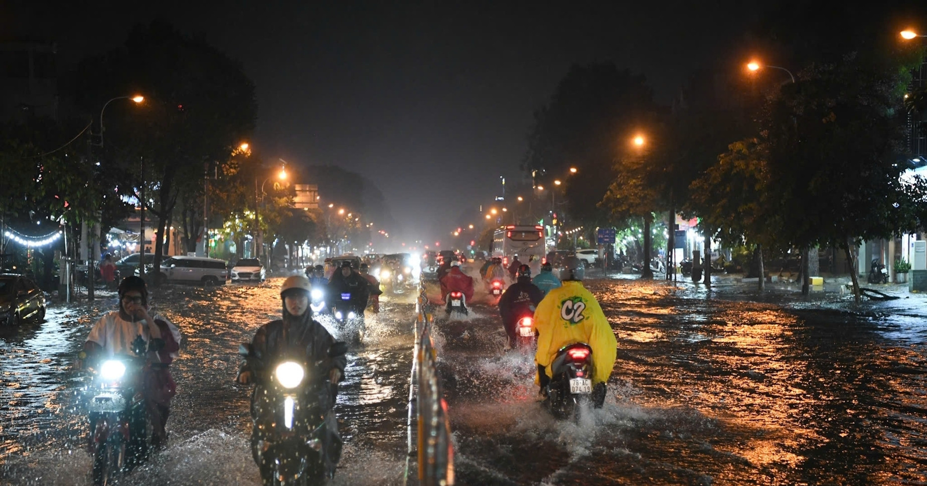
The timing of the storm coincided with the evening commute, creating a compounding crisis of volume and velocity. In areas like Thảo Điền and along Quốc Hương street, water reached nearly half a meter. The An Phú underpass became a particular bottleneck, with Baomoi reporting that vehicles struggled significantly to navigate the submerged tunnel. The impact extended to the city's western gateway. On Tên Lửa street in An Lạc ward, flooding was widespread, while nearby Sinco road recorded water levels above 0.5m. Even after the rain subsided, water remained stagnant on Sinco road, continuing to disrupt local residence and commerce. The severity of the event created a sharp contrast in resident perspectives. Mr. Tuấn Anh, a resident of An Lạc ward for over 30 years, told Vietnamnet that while general flooding has decreased compared to previous decades, extreme events like the September 10 storm still cause total disruption to daily life.Meteorological Drivers and Forecasts
The Southern Regional Hydro-Meteorological Station identified two primary mechanisms behind the weather event. Satellite imagery showed developing convective clouds causing thunderstorms and lightning across the city center and the northern and northeastern wards. The technical cause was the activity of the Southwest monsoon combined with a tropical convergence zone whose axis passed through the South Central coast. While the immediate aftermath saw a forecast for the next three hours suggesting rain of 10-35mm (with some areas over 40mm), the long-term outlook remains volatile. For September 12 and 13, the South is expected to maintain a pattern of thunderstorms and localized heavy rain. Although the total volume is projected to trend downward on those specific dates, the regional trend indicates that rain in Ho Chi Minh City and the broader South will continue to increase in both area and volume in the coming days.Frequently Asked Questions
Which areas were most affected by the flooding?
High-risk zones included the An Phú underpass, Thảo Điền, Quốc Hương street, Phan Huy Ích, Phạm Văn Chiêu, and Sinco road in An Lạc ward, where water levels often exceeded 0.5m.
Related YouTube video

What caused the extreme rainfall on September 10?
The rain was caused by the Southwest monsoon and a tropical convergence zone passing through the South Central region, leading to the development of convective clouds over the city.
Was this a typical rain event for the year?
No. The Southern Regional Hydro-Meteorological Station confirmed this was the largest rain event recorded in the city since the beginning of the year.
Impact on Transit and Local Commerce
The flooding extended beyond major arteries, infiltrating residential and commercial zones. VTC News, via Baomoi, recorded significant water accumulation on Cây Keo street in Tam Bình ward, as well as Lê Văn Việt and D5 streets in the former Bình Thạnh district. The surge in vehicle volume during the evening rush hour compounded the crisis, forcing many motorcyclists to abandon their vehicles and wait for water levels to recede or navigate via sidewalks to avoid deep pockets of water. For foreign visitors and newcomers, the sudden shift from prolonged heat to extreme precipitation proved disruptive. Sonya, a Russian tourist, reported her motorcycle broke down after attempting to cross a submerged section at the start of Quốc Hương street. Similarly, Ngọc Thảo, a resident of Khánh Hội ward, noted she was unaware that the Thảo Điền area was a frequent flooding hotspot.Secondary Rainfall Data and Regional Risk
While the city center faced paralysis, data from the Southern Regional Hydro-Meteorological Station indicated widespread high-volume rainfall across several outlying districts and neighboring provinces. The environmental impact exceeded simple flooding. Danviet reported that the combination of lightning and strong wind gusts caused trees to be uprooted and fall across roadways, creating further hazards for pedestrians and blocking emergency access. Meteorological forecasts for September 12 and 13 indicate that while the total volume of rain in the South may trend downward, the general pattern of thunderstorms and localized heavy rain will persist. For residents in high-risk zones, the next step is to strictly monitor weather bulletins to select safe travel routes and avoid areas prone to deep flooding and falling debris.Archypedia is dedicated to independent, evidence-backed reporting. This briefing was synthesized from primary source reporting, corroborated across independent newsrooms, and verified against our Editorial Standards.
Transparency record
Evidence behind this report
This report synthesizes 4 distinct sources. Open the source ledger below to compare the underlying coverage.
Prepared under the Archypedia Editorial Policy by the Elena Voss editorial desk profile. AI-assisted tools may support drafting and verification; public accountability remains with Archypedia. Report an error.